

Farbreiga [Fear Breige]
Good walks are even better shared.
Overview
Farbreiga [Fear Breige]
Overview
Nestled within the serene Irish Sea Coast Mountain Range, Farbreiga, or Fear Breige, stands with an elevation of 675 meters. Its name, which translates to 'sadness', is steeped in myth and history, catching the imagination of hikers drawn to its picturesque views and rich lore.
Geology
Farbreiga boasts Old Red Sandstone, its reddish hues marking a landscape that tells a tale of geological history stretching back over 400 million years. A subtle reminder of the Earth's ancient past, the rocks here are a sight to behold—a real geologist's playground!
Routes
The Slieve League Trail Approach is the most popular route, stretching 10.5 km over stunning greenery to a breathtaking summit. This moderately challenging path takes about 4 hours, leading you through an ever-changing landscape that reminds hikers that nature is the best artist.
Summit Features
Upon reaching the summit, you are greeted by a sturdy stone cairn that can be a perfect photo op, not to mention a good excuse to catch your breath while you take in the utterly breathtaking views of Donegal Bay below.
Terrain Type
Expect a mix of rocky outcrops and grassy meadows, interspersed with patches of bog. Remember, those bogs aren't just for decoration—they can be slippery! A good gaiter can save you from the unexpected plunge into the mud!
Views
The panoramas are a feast for the eyes! On clear days, you'll marvel at the sight of the Slieve League cliffs, and the Atlantic Ocean glimmering in the distance. Spring and autumn are the best times to capture these stunning vistas—less chance of being shrouded in a blanket of clouds or rain.
Hazards
Be aware! The terrain can be quite uneven, and the weather here is notorious for changing quickly. One moment you might be basking in sunshine, and the next you’re in a light drizzle—I guess that’s what you get on an Irish hike!
Nearby Summits
Take the opportunity to explore nearby summits like Slieve League at 601 meters and Benbulben at 497 meters. They also offer stunning views and enjoyable hikes, perfect for a day of adventure.
Access
For those arriving by car, the nearest parking is found in Carrick Village. If you prefer public transport, a local bus service connects Donegal Town to Carrick. While Carrick may be small, it offers charming spots for food and refreshments,
Facilities
As charming as Carrick is, facilities around Farbreiga are limited. Treat yourself to a hearty meal or a hot cup of tea after your hike—the perfect ending to your adventure.
History
Farbreiga's name is not only a nod to local legends but also offers a peek into the ancient tales that adorn the mountain. This area has had its share of stories rich with drama and humanity, adding a touch of allure to your hiking experience.
Whether you’re a seasoned hiker or just fancy a day out in nature, Farbreiga promises a memorable adventure filled with stunning views, fascinating history, and the slight risk of getting bogged down—figuratively and literally!
Explore routes near Farbreiga [Fear Breige]
Public walks starting within 80 km of this hill. Nearby does not mean a route reaches the summit; check its map and access before setting out.
No public routes are currently listed within 80 km of Farbreiga [Fear Breige] on Walkmates. This does not mean there are no paths here. Explore the map and check local access information before planning a walk.
Route planning notes
These notes describe possible approaches, not verified navigable routes or permission to cross land. Check current paths, local access rules and conditions before setting out.
Slieve League Trail Approach
Starting from Carrick and weaving through green fields, this route offers stunning coastal views before the final ascent.
Make a day of it, together
Find someone to share the walk with, or organise a day out along a route you like.
Photo Gallery
View all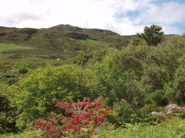 Photo could not load
G1702 : Farbreiga from Largan
Liz McCabe
Hill facts and local notes
Classifications
Elevation
395m
1,296 ft
Prominence
238m
Coordinates
53.9652, -9.2654
G170025
OS Map
31
At the Summit
The summit is marked by a substantial stone cairn, adding to the dramatic scenery. You'll feel like you're on top of the world—or at least the top of County Donegal!
Terrain & Geology
The geology of Fear Breige primarily consists of Old Red Sandstone, identified by its reddish hue, the result of iron oxide. This period dates back over 400 million years, making it a geological treasure trove for enthusiasts.
Views & Scenery
From the top, you can gaze over Donegal Bay, the Slieve League cliffs, and even out towards the islands of the Atlantic. Bring your binoculars!
History & Heritage
Name Origin
Farbreiga means 'sadness', believed to be connected to local folklore about a tragic tale of lost love.
Historical Significance
Fear Breige is deeply rooted in Irish mythology, often featured in stories of ancient tribes and mythological challenges.
Getting There & Facilities
Check current local access restrictions, parking rules and transport timetables before travelling. These notes do not confirm public access to the summit.
Parking
The nearest parking is available in Carrick Village, which has a large gravel lot just off the road to the trailhead.
Public Transport
Buses from Donegal Town regularly ply the route to Carrick. Check local schedules for the latest timings.
Nearby Facilities
There are no facilities directly at the foot of Farbreiga; however, Carrick provides quaint pubs and cafes for a hearty meal post-hike.
Safety Information
Known Hazards
- Uneven, rocky terrain can lead to slips, especially in wet conditions. Expect sudden weather changes; pack layers to avoid turning into a human icicle!
General Safety Tips
- Check weather conditions before setting out
- Carry appropriate clothing and equipment
- Let someone know your planned route
- Take a map, compass, and GPS device
- Carry emergency supplies: food, water, first aid kit, torch
Hills
Some common questions about the hills answered
Are there group walks up Farbreiga [Fear Breige]?
Many walkers use Walkmates to join or organise walks with others. You can check for group walks around Farbreiga [Fear Breige] through the maps
Are there other walkers around Farbreiga [Fear Breige]?
Activity varies by location and time, but Walkmates lets you see whether others have shared walks or shown interest in this area. Find other people through the walking friends search walking friends for Farbreiga [Fear Breige] search or of course create your own walk for Farbreiga [Fear Breige]
Can I organise a walk to Farbreiga [Fear Breige]?
Yes. If there aren’t any walks listed already, you can create a walk and make it available for others to join.
If you're signed up to Walkmates, you can create a walk to Farbreiga [Fear Breige].
How do I find a walk up this hill?
There are often multiple ways to walk this hill, depending on experience and route preference. Walkmates helps you explore walks and routes that others have shared.
Can I suggest a new route up Farbreiga [Fear Breige]?
Yes. You can suggest or create routes to share with others. Walkmates focuses on the social side of walking, so routes are used to help people organise walks and explore areas together, rather than as detailed navigation tools or route libraries.
Other uses really appreciate knowledgeable walkers sharing their routes. Share your favourite route to Farbreiga [Fear Breige] here
The is an error or something incorrect about this hill. How do I let you know?
We always strive to keep the information on Walkmates as accurate as possible. If you find an error, please let us know through the contact form and we'll aim to correct it as quickly as possible
Community Discussion
Comments
Location
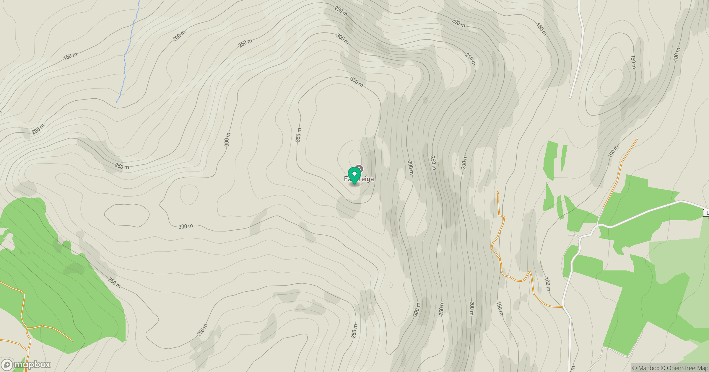
Grid reference: G170025
View on OpenStreetMapOpens a map in a new tab, centred on the hill.
Hills within 30 km
Straight-line distance, not a walking route or confirmation of access.
No comments yet. Be the first.